Wild and wonderful.
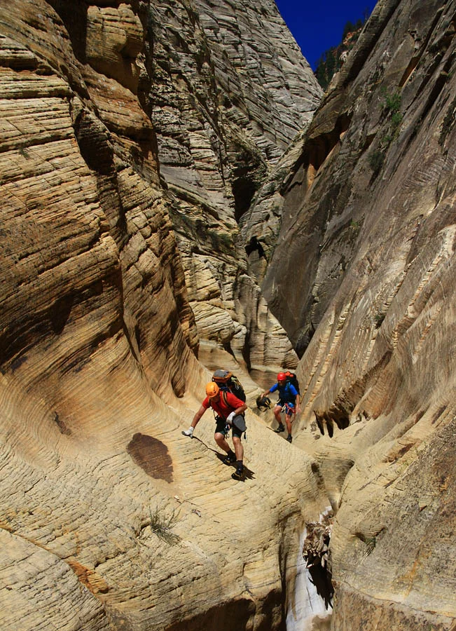
One of Zion’s big canyons, Checkerboard has a wonderful wild character not found in the more well-known canyons. Hopefully, the long approach and even longer exit will help maintain this character. Checkerboard is one of the few Zion canyons featuring slides. And while it has a lot of sports action on the order of Imlay, the canyon terrain is varied and includes sections of easy walking in beautiful slanted hallways. Expect a big day!
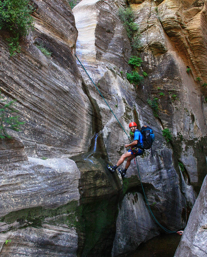
The canyon is dominated by short rappels, slides and downclimbs. It is usually not wet until the end. Make sure your rope is long enough for the dramatic last rap – and maybe best to set up a contingency anchor there, just in case. The landing at the bottom varies substantially in height.
WGS84 Zone 12S Waypoints (UTM)
Parking Spot Dakota Ridge: 335210mE 4135620mN
End of Dakota Ridge: 329745mE 4136290mN
Ridge above first Rap: 328560mE 4135385mN
First Rappel: 328585mE 4135080mN
Canyon Profile
Logistics

RATINGS
3B IV ★★★★☆

TIME REQUIRED
12-15 Hours

PERMIT
Yes. You will also need a Narrows day-hiking permit, which you can reserve in advance; a good idea in the busy season.

SEASON
Summer or fall

LONGEST RAPPEL
205 feet (63 m)

ACCESS
Begins off Dakota Ridge, and ends in the Narrows

EMERGENCY
Zion Wilderness Desk: (435) 772-0170
Zion EMERGENCY: (435) 772-3322
Equipment

ESSENTIALS
Helmets, rappelling gear, webbing and rapid links. This canyon is rarely done, so you will likely need to build at least a couple of anchors. Many people will like to have poles for walking out the Narrows. A good headlamp is advised. Make sure your rope is long enough for the last rappel.

COLD WATER PROTECTION
Wet suits likely needed in all but the hottest/driest weather.

DRINKING WATER
Bring plenty. On the hike out, water can be taken directly from Big Spring.
Difficulties

FLASH FLOOD RISK
Moderate to High: the final section of narrows is fairly long. Exiting the Narrows in a flood would not work.

SKILLS REQUIRED
This is a long, involved canyon in a wilderness setting. Natural anchors predominate.

ANCHORS
The two longest raps are bolted, but all other raps are off natural anchors. Please do not add bolts to this canyon.
Seasonal Adjustments
It likely holds snow in its depths well into the spring—caution advised.
Approximate Times
Driving from Springdale: 1 hour
Approach to first rappel: 3-5 hours
Hike out: 4 hours
TOTAL car-to-car time: 12-15 hours
Getting There
Click to view larger image.
Spot an Exit Vehicle: The exit is out the Narrows, so spot a car at Canyon Junction (in-season) or at the Temple of Sinawava after the shuttles stop running.
Getting to the Start: An early start is advised. The canyon starts on Dakota Ridge, off the North Fork Road. The road can be impassable when wet, even to HC 4WD vehicles. From Springdale, take Utah Route 9 through the Park 2.3 miles past the East Entrance then turn left (north) onto North Fork Road. The road is paved at the beginning but soon turns to dirt. At 11.4 miles, note a dirt road on the left, signed for Orderville Canyon ORV Area. Continue straight on North Fork Road another 2.5 miles to a small road on the left at the apex of a 90-degree rightward bend. This is the Dakota Ridge Road. There is a shack on the right side of the road about 100 feet from the North Fork Road.
Follow the rugged Dakota Ridge Road 1.23 miles to an open area and a road junction. The road has numerous washouts and rocky sections. While 4WD is not required, high clearance is… for all but the most reckless drivers. Park near the road junction, off the road. It is possible to continue down the right-hand road another 0.3 miles, but this section is very rutted and slow, so walking might be faster.
The Approach
The canyon itself is all the way at the end of a long, uneven ridge. Allow 3-4 hours to get to the first rappel. A GPS can be useful on the approach, though a good map and terrain reading skills are probably more essential. Long pants make unavoidable sections of nasty brush less painful.
From the carpark, follow the right fork of the road as it cuts down across the north end of the hill. It soon deteriorates as it crosses the top of a couple gullies. About ¾ mile from the carpark, the road turns sharply left (south) just as the slightly-rocky summit of Dakota Hill comes into view. Do not follow the road south; instead continue west toward Dakota Hill, finding a bit of a path on the crest of the ridge. Follow the crest of the ridge all the way to the northeast peak of Dakota Hill, then follow the crest of that ridge to the named summit.
From the summit, there are several options, but I prefer following the ridge to its end. Work your way down the steep west face of the peak, then work right to regain the top of the ridge again. Follow the ridge over many lumps to its end. Hike past the final cliffy lump and descend easily to the flat land below at the head of the V-shaped valley running southwest; this is the Checkerboard drainage.
You can descend into the V-shaped valley right away, but it holds lots of nasty wild rose. It is better to follow the right edge of the valley for 15-20 minutes until above the first rappel, then work your way down the slope, weaving between small cliff bands, to access the canyon floor near the top of the first rappel. Follow the canyon floor to the first narrows and the first rappel.
The Business
R1: 190 feet (57m) off bolts to a shallow pool or mudflat below.
Cut right around a scrappy narrow section and downclimb a slab. Walk around the next little narrows too, then rappel (R2) from a rock anchor to a ledge with logs. Rappel (R3) 100 feet (30m) from logs down two levels to a shady spot. This section can be hot.
The nature of Checkerboard is similar to a Wingate canyon. The watercourse zigs and zags, with some sections of easy walking in a sandy or rocky streambed, while other sections feature numerous small rappels. In all but the driest weather, the narrow, rappelling sections might have pools of various depths. Actual swimming is unlikely until near the end.
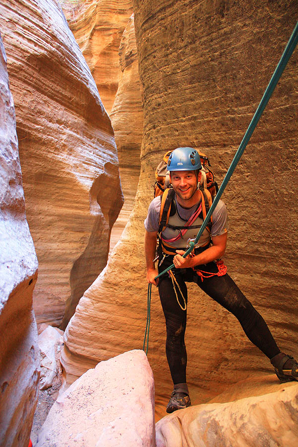
Traipse downcanyon, building anchors and rappelling as needed. In several places, scary-looking slides turn out to be fun and safe, even when wet. The canyon has around 15 rappels, most in the 20-40 foot range.
After an amazing, long and very scenic slanted-corridor section, the canyon begins to plunge toward the Narrows. A very dark section leads to several rappels into pools. This marks the beginning of the end. The river comes into ear-shot. The final rappel, off a two-bolt anchor, is down an awesome flute. It is every bit of 205 feet – this would be a bad time to discover that your rope is not long enough!
The Exit
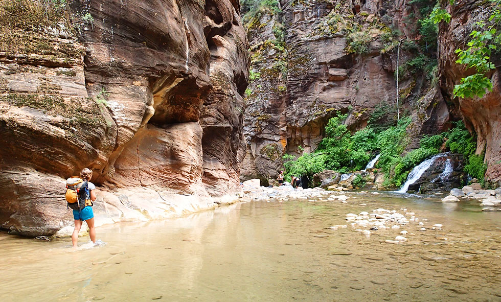
Checkerboard ends at Campsite 9 in the Narrows, below Kolob but above Goose Creek. Hike downstream 1.2 miles to Big Spring where spring water is available, but watch out for abundant poison ivy on both sides of the stream. Continue down the Narrows to the Riverside Walk, then on to the Temple of Sinawava.
Author's Experience
The first descent of Checkerboard was by Kip Marshall, Rhett Chambers and Matt Smith on October 10, 2003, in very wet conditions with no wetsuits. They got cold.
The second descent was a few days later, and I was lucky enough to be invited along. The canyon was kept on the down low for many years.
Since then, I have descended it sporadically, a total of 6 descents (maybe) in 12 years.
Trip Reports
Exterior Links
Mishaps and SAR Incidents
(No SARs so far, let’s keep it that way)
Maps
Checkerboard East. Click for higher resolution
Checkerboard West. Click for higher resolution.


