

Picking the Plums.
Imlay is one of the best canyons in Zion, if not THE best. The first descent required three days and was a feat of amazing bravery and chutzpah. With knowledge of the route, fixed anchors, modern techniques and modern equipment, it is now a wonderful journey with pothole challenges that add spice.
The Sneak Route enters the canyon near the halfway point, gaining the very best canyon sections with minimal effort. It is sometimes used as a day-and-a-half route, bivying at the alcove before getting wet. Skilled parties can complete it in a reasonable day with an early start.
From The Grotto in the main canyon, follow the West Rim Trail about half way to the rim, then cross-country over two passes and into Imlay canyon. Follow Imlay through its two fabulous narrows to The Narrows, and hike out to the Temple of Sinawava. Getting a "White Pass" allows parking at The Grotto before the buses run in the morning.
There are two 'sneak routes’. They go left and right of Point 6630. I find the Right Sneak to be faster and easier. The Left Sneak will be presented as an alternative.
First descent: June 7–9, 1978 by Mike Bogart, Mary Dern and Dennis Turville
GPS Waypoints: WGS84 UTM 12 North
326562mE 4128457mN Leave West Rim Trail
326572mE 4128559mN edge of drop into bottom of Telephone Cyn
326579mE 4128678mN first top of hill
326548mE 4128989mN turn right into R Sneak wash


Canyon Profile
Logistics

RATINGS
4B IV ★★★★★

TIME REQUIRED
9 to 14 hours

PERMIT
YES. If seeking an early start, be sure to ask for a White Pass that allows parking at The Grotto.

SEASON
Summer or fall

LONGEST RAPPEL
110 feet (34 m), the last rappel. Other raps on the Sneak Route are no longer than 60 feet, though the first rap requires a bit more than this to easily pull.

EMERGENCY
Zion Wilderness Desk: 435-772-0170
Zion EMERGENCY: 435-772-3322

ACCESS
Starts by hiking up the West Rim Trail; finish by hiking out The Narrows. During shuttle season, this only requires one car as long as you make the last shuttle. In late fall, a short car shuttle is required.
Equipment

ESSENTIALS
Hooking Kit, helmets, rappelling gear, webbing and rapid links.

COLD WATER PROTECTION
Thick wetsuits or drysuits required at all times of the year.

DRINKING WATER
Carry plenty. Once in the canyon, filterable pothole water is available.
difficulties

FLASH FLOOD RISK
Very High - there are long sections of narrows and a large watershed above.

ANCHORS
A mix of natural and bolted, bring webbing and quicklinks.

SKILLS REQUIRED
Efficient travel, problem solving, pothole escapes, staying warm.
SEASONAL ADJUSTMENTS
Summer and Fall are the best times for Imlay. Snowpack in winter and spring could make both the approach and the canyon extremely difficult and dangerous. Helps to get a really early start in summer; hitting the trail 2 hours before dawn being ideal.
The important variable for Imlay is the water level in the potholes. High water = fast, cold and easy. Low water = slow, difficult and not so cold. Snowmelt and thunderstorms fill the potholes. Continuous hot dry weather takes the water away. Knowledge of recent weather or recent trip reports can clue you in, but you should ALWAYS be prepared to hook out of potholes.
Getting there
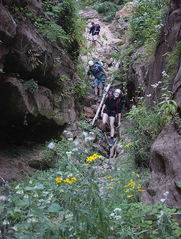
From The Grotto shuttle bus stop, ascend the West Rim Trail to Scouts Lookout. Follow the trail left along the ridge then down the end to a small wooden bridge crossing a branch of Telephone canyon. Continue along the trail 300 feet (3 minutes) until a zero-impact slickrock route can be found that takes you down and right toward the canyon bottom. Follow social trails down to the edge of the slot, then find a distinct steep path down to the bottom. Cross the canyon and proceed right a few feet, then climb slickrock up to the rim.
Follow social trails north toward the ridge ahead. Just before the ridge steepens, the trail crosses a short swampy area, the result of the wash coming from the Right Sneak.
Right Sneak - Turn right and, after a brief bushwhack, follow the sandy wash which quickly turns left and heads toward the notch between peaks. Hike, scramble and bushwhack for a while. Climb up the end of the canyon to a pass then down the other side. Continue straight ahead, and climb to a second pass. A steep, dirty slab can be bypassed by backtracking 100 yards, climbing steeply among small oaks to the west of the base of a short, steep, clean slab. Ascend the slab 10 feet (3m), (5.5ish), then traverse upcanyon to the top of the dirty slab and continue up the watercourse to the pass.
Descend the canyon on the other side until the last possible place to climb easily up right onto the slickrock bench. Traverse the steep slickrock until the buttress mellows out. Follow the buttress down toward the big wall ahead. Near the canyon, cut down, left and easily cross the previously followed slot near the edge 100 feet above the canyon. Traverse slickrock onto a steep, sandy, tree-covered ridge beyond. Descend steeply to the canyon floor.
(Var-2) – after stepping right onto the slickrock buttress, follow the slickrock buttress down then right to the edge of the inner gorge across from a deep alcove. Work carefully down very steep slabs to the alcove. This makes an excellent bivy site. Using Var-2 gets you there without getting wet or rappelling.
(both) You are now at the Crossroads. The first water is just ahead; find a good place to suit up. There is a nice low-angle slab that works well.
Left Sneak - Better in Winter – It is also possible to sneak the route between PT 6630 and the West Rim, or the Left Sneak Route. From the swampy bit, continue up the ridge 15 minutes until it steepens, then find a way down into the canyon on the left (west). Follow this canyon up over a pass and down the other side. A steep, broken-up area about halfway down can be descended without rappels, but it may be easier to just rappel. There is a hidden natural bridge in this section. This variation accesses Imlay canyon 100 yards higher than the Right Sneak.
The Business
The Crossroads and Extreme Narrows
The Crossroads is an area where numerous canyons come in from both sides. The Sneak Routes comes in on the right at the bottom of The Crossroads. After The Crossroads, the canyon provides about an hour of moderate canyon with rappels and swims, though it tends to collect wood debris and can have some nasty log soup to deal with. Be careful of unstable log jams that may develop in this area.
Imlay seems to change more than most canyons, so consider every sentence in this description to start with “usually”. We “usually” suit up where the sneak route enters Imlay canyon.
A few minutes below the suit-up spot, there has been of late a log jam, and wood debris may require a rappel. Treat wood jams with caution as they may be unstable. A short swim follows; then a short rappel off-bolts into a pothole. The anchor here is also the anchor for the next drop 30 feet away, so don't be too hasty in pulling your rope. Rap the second part into a pool, the water source for the bivy alcove. The total length of this rap is close to 60 feet, but another 10 or 15 feet of rope is required to get a good angle for the pull.
The large overhang (accessed directly by approach Var-2) can be an excellent place to bivy.
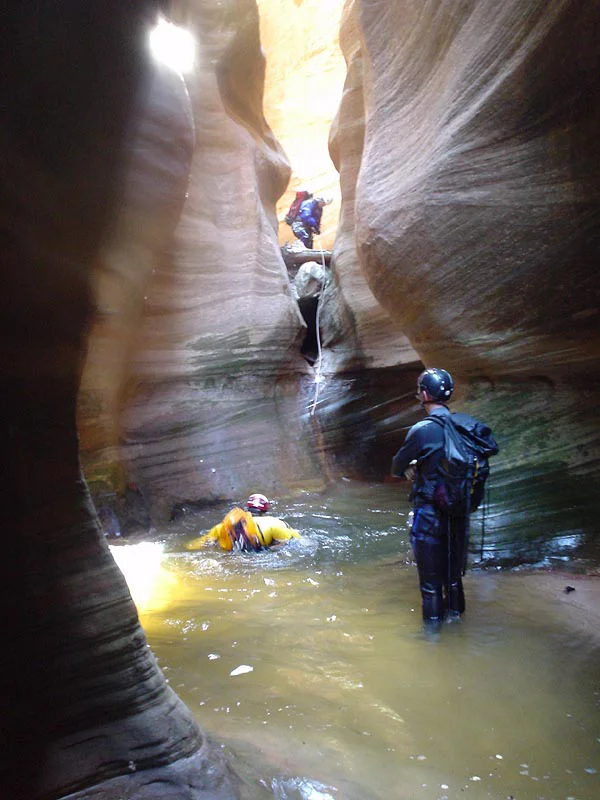
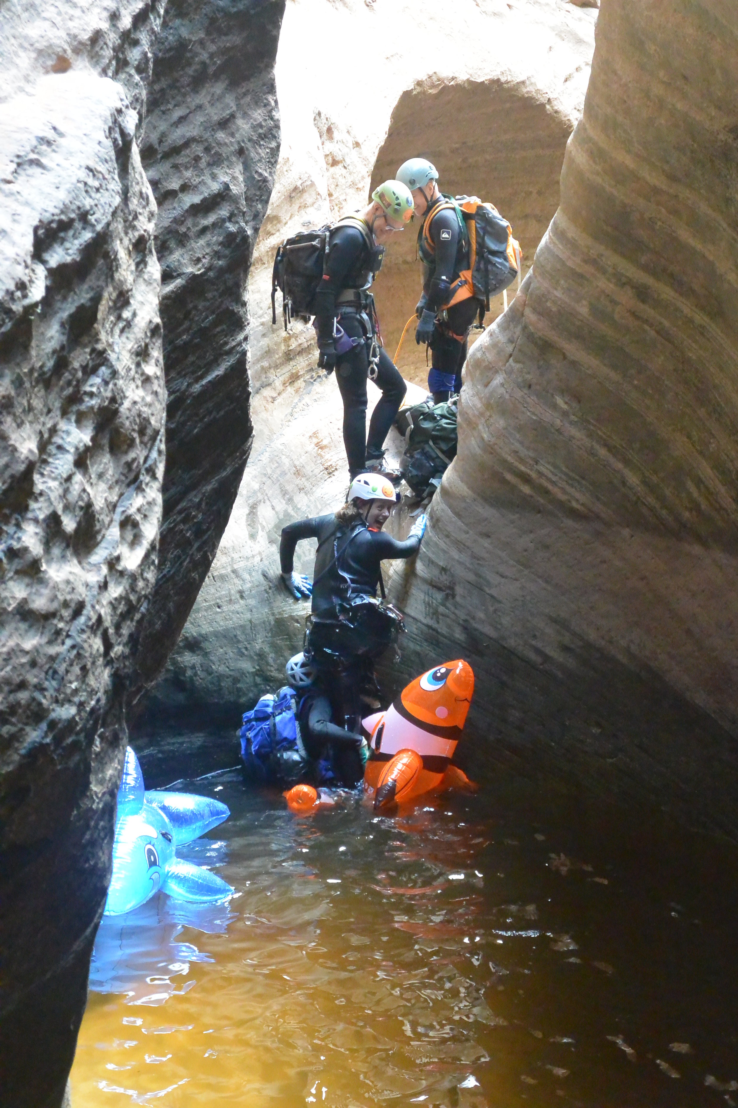
The next section I think of as The Corridors. Several long straight sections provide a few swims and short rappels, some of which can be downclimbed. This section collects wood and makes troublesome log soup at times. Without log soup, it takes half an hour to reach the first rap into the Extreme Narrows.
Note: it is possible to exit the canyon right at the start of the first section of extreme narrows and proceed overland to bypass them – but it is reported to be loose, dangerous and ugly.
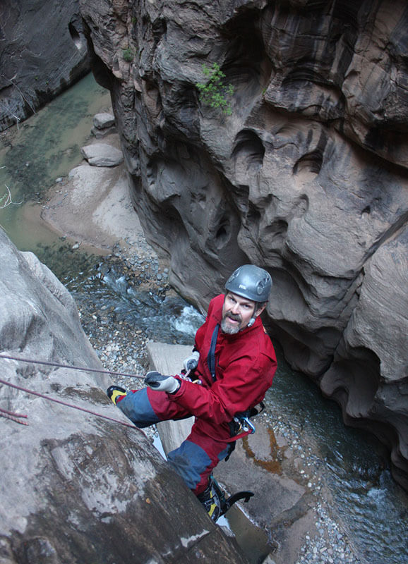
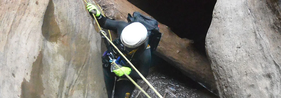
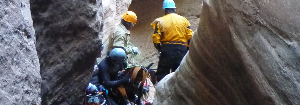
Enter the narrows - dark, heavily sculpted, deep within the rock, fabulous. Rappels and problems come back to back, requiring strenuous climbing, swims, pothole escapes, pack tosses, ingenuity and, as a last resort, drilling and hooking. Features in this section include the Arch Rappel (now done off a bolt anchor); the Birth Canal (a narrow V that is climbed through, or OVER when blocked with wood debris); Big Bertha, the first big keeper pothole, with flat ground beyond denying PotShot-toss effectiveness; the Stump Lasso to cross a deep pothole; and the Basketball Jones leap for a rim-grab. After an hour or two or three, the canyon relents and opens up briefly, allowing for a lunch and pee break in the sun. A safe bivvy can be found by climbing slabs out of the canyon to the left.
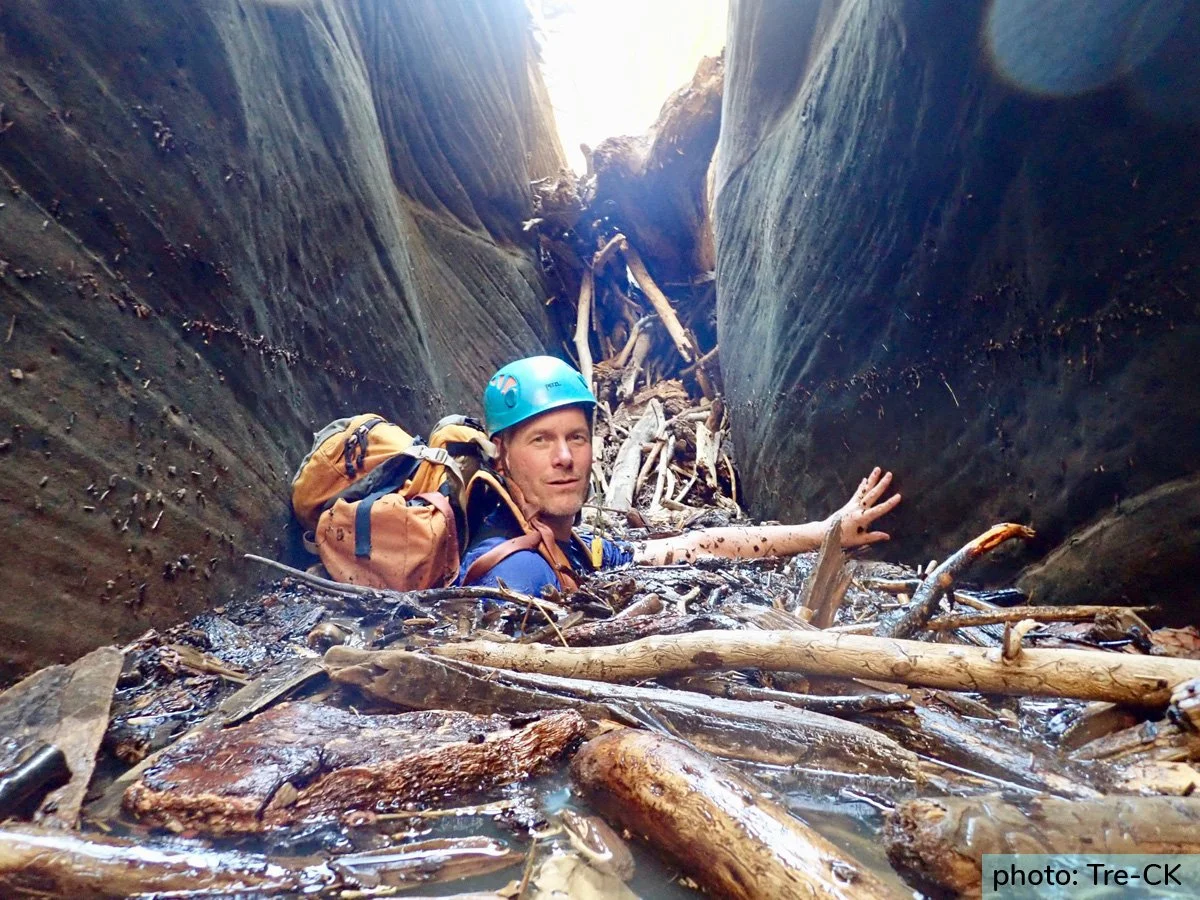
Luke Galyan enjoying Log Soup in The Corridors Section, July 2018
The second extreme narrows, the Terminal Narrows, is somewhat shorter, but still takes an hour or two or three to traverse. There are several keeper potholes back to back that are difficult at certain water levels. The terminal narrows finishes with a deep pothole that recently has had a large log in it allowing easy escape. Past this is a long rappel (55 feet, 18m) into a long pool. At the end of the pool, the canyon jogs left to a large ledge overlooking The Narrows of the North Fork. Rappel 110 feet (34m) to the river, and pack up your gear.

The Exit
Hike The Narrows to the Temple of Sinawava, about 1-1/2 hours.
Author's Experience
I first did Imlay Sneak Route with Shane Burrows and Scott Holley in 2001 and then again three weeks later with Scott and a friend of his, doing the Full. Mel Brown, Steve Brezovec and I did a winter Imlay Sneak in February 2003, and I have done Imlay once or twice a year since then, usually by the Sneak route.
Trip Reports

Stories
Descents by Dennis Turville - A selection of canyon descents by Dennis Turville, Mike Bogart, et al.
German Tourists in Imlay - Barb Pollyea writes of her first trip through Imlay Canyon.
Sneak Route: Imlay, 2/23/02 - Tom. Steve Brezovec and Mel Brown do Imlay in the winter.
ACCIDENTS
Injured Canyoneer Short-Hauled from Imlay Canyon
Date: July 18, 2014
Springdale, UT- On Wednesday, July 16, Zion Search and Rescue worked to reach an injured hiker in Imlay Canyon and bring him to safety for medical attention. The injured man and four companions began their two-day descent of Imlay Canyon on Monday, July 14. On Tuesday morning one member of the party injured his knee and was unable to continue the descent. The group had completed 22 of the 42 rappels that are required when descending Imlay.
After assisting the injured man to an area safe from potential flash flooding, three members of the canyoneering party continued their descent on Tuesday to report the injury. The injured man and a companion prepared to spend the night in Imlay until rangers could safely reach them.
Imlay Canyon is a strenuous, challenging technical canyon with an approximate 2200’ descent. Imlay lies within a large watershed and features long sections of narrow canyon walls. The hike out of Imlay includes a two-hour hike down the North Fork of the Virgin River, a popular hiking route in Zion also known as the Narrows. A flash flood warning was issued Tuesday afternoon and was still in effect when the report of the injured hiker was made.
Zion rangers planned rescue efforts for Wednesday morning based on the initial report and a helicopter flight over Imlay Canyon. The injured man’s party provided excellent information about the injury, the location of the injured man and his companion and details about their preparation with food and equipment to spend the night in Imlay. This allowed rangers to accurately determine the urgency of the response and assemble contingency resources.
Early Wednesday morning, the Zion Search and Rescue Team began rescue efforts by short-hauling two ranger/medics into Imlay Canyon. Upon reaching the injured man, they stabilized his injury and assisted him to a site where he and the rescuers could be short-hauled out of the canyon. The injured man was short-hauled out of the canyon just after 2:00 p.m. A rescue team of eighteen rangers, technical rescuers, and helicopter crew members contributed to the success of the operation.
Zion National Park is well known for its many canyoneering routes. Water carved the canyons and features that hikers are drawn to, but it also heightens the risk factor of canyoneering, especially during monsoon season. Long and overnight canyoneering routes carry greater risks of flash floods during monsoon season because weather can worsen quickly. Tuesday night as the injured man and his companion waited for rescue, a flash flood occurred in Imlay Canyon. From their safe vantage point they observed the water rise approximately 15 feet in a short time.
Maps
Click for higher resolution


Went through Full Imlay with Steve Brezovec and Kelly Birdwell - to enjoy the canyon, of course, and to work on the anchors. (All photos this rave by Steve Brezovec.)