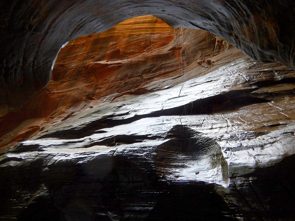
A Subterranean Wonderland.
With the Weeping Rock area closed, Middle Echo can only be approached from above, via the Stave Spring Trailhead. The approach not too bad - it is climbing 1000 feet back out after doing the canyon that discourages people.
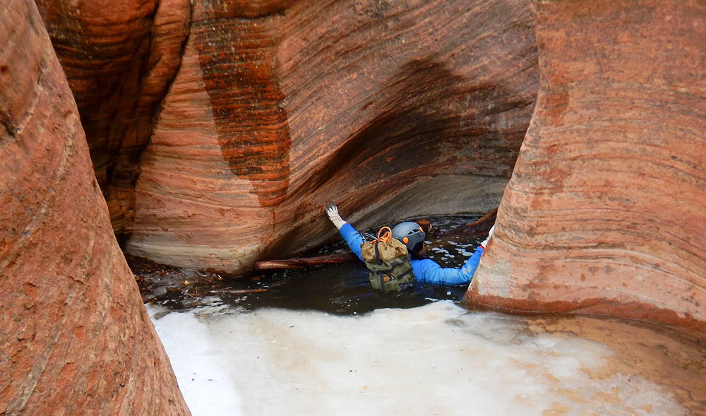
Echo is a large canyon complex that drops into the main Zion canyon at Weeping Rock. The middle part of Echo ("Middle Echo") offers an amazing canyoneering adventure. A couple of short rappels and some very chilly swims access a long section of narrows deep underground. Due to its large watershed, the pools are often full of water, and they maintain their coldness long into the summer. At times, the pools fill with decaying vegetable matter and smell like poo. Canyoneers sometimes wonder if they will pass out from the smell before making it through the pools.
Echo collects a lot of snow and ice over the winter, and should be avoided through the spring. It often stays impassable into June, and the snow blockage occurs after the rappels! In the last couple of years, groups have been rescued so the Park often closes the canyon in the spring until the melt out has completed. Check with the Wilderness Desk for current conditions.
One can assure passage in Middle Echo by hiking from the end of ‘Middle’ to the bottom of the last rappel, discovering if such a hike is possible. BEFORE the meltout, it can be possible to climb over the frozen snow and ice, but once flow starts it tends to carve out underneath, creating a hazard way too dangerous for rational human passage.
The Echo Canyon Trail is the oldest trail out of Zion Canyon. In the late 1890's, Utah pioneer John Winder reworked the existing Paiute foot trail to drive cattle up to the rim. The trail was improved and the Observation Point Trail cut into the side of the mountain in 1925.
Canyon Profile
Logistics

RATINGS
3BII ★★★☆☆

TIME REQUIRED
3-6 Hours

PERMIT
REQUIRED. Group size limit is 6.

SEASON
Summer or fall

LONGEST RAPPEL
30 feet (10 m)

SKILLS REQUIRED
No special difficulties, but in certain conditions, one pothole exit can be difficult to do without a partner assist. Soloing Echo is not recommended.
Equipment

ESSENTIALS
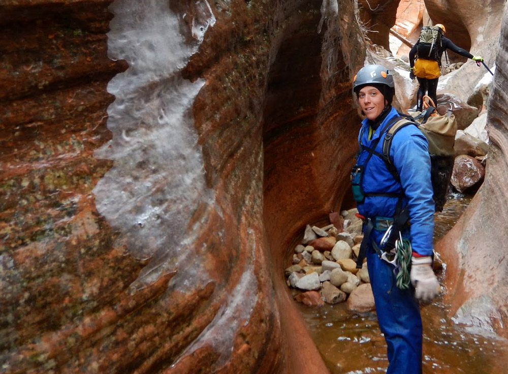
Helmets, rappelling gear, webbing and rapid links.

COLD WATER PROTECTION
Wetsuits required, even in summer

DRINKING WATER
Very little. Bring Plenty.

FLASH FLOOD RISK
Moderate – Sustained narrows take only 1-2 hours to traverse, but the collection basin is large and all slickrock.

ACCESS
Drive your own vehicle to Stave Spring Trailhead.
SEASONAL ADJUSTMENTS
Winter - Echo collects a lot of snow and ice over the winter, and should be avoided through the spring. It often stays impassable into June, and the snow blockage occurs after the rappels! In the last couple of years, groups have been rescued so the Park often closes the canyon in the spring until the melt out has completed. Check with the Wilderness Desk for current conditions.
One can assure passage in Middle Echo by hiking up from the bottom to the bottom of the last rappel, finding out if such a hike is possible. BEFORE the meltout, it can be possible to climb over the frozen snow and ice, but once flow starts it tends to carve out underneath, creating a hazard way too dangerous for rational human passage.
Getting there
Access to the trailhead is via the Zion Ponderosa Ranch Resort and the “Stave Spring” trailhead. The dirt roads can be difficult or impassable after rain.
Driving Directions: From Springdale, drive north and east on Route 9, through the Pine Creek Tunnel, past Checkerboard Mesa and out the East Entrance of the park. Two miles further, turn left onto the North Fork Road. Drive five miles and turn left into the Zion Ponderosa Ranch Resort. If the North Fork Road turns to dirt, you have gone too far. Turn around and return about ½ mile to the Zion Ponderosa. Reset your odometer upon entering the Ponderosa.
Entering the Ponderosa, do not go left and down to the main buildings, but follow the road around to the right past a ‘cabin’ (pretty nice cabin) and over the crest of a hill, where the road turns to dirt. Follow this road about 0.7 miles to an intersection with a sign indicating Observation Point straight ahead and Cable Mountain to the left. Turn left toward Cable Mountain. Follow the main dirt road (right at a Y) 0.6 miles to another Y intersection. Here go left and then right, past another Cable Mountain sign. Follow this road 0.6 miles to where it ends at a parking lot just inside the park boundary. The last 0.1 mile of road is rough. Parking on Ponderosa land is prohibited, so be sure to cross into the Park and park there.
Walking Directions: from the trailhead, walk out an old fire road and follow as it curves around to the left. At 0.4 miles, it intersects with the Echo Canyon Trail. Turn right onto the new trail. Follow as it winds its way across the meadowy flats next to a shallow drainage. About 0.5 miles along, cross the drainage and follow the rim of a canyon with awesome views. Descend a ridge into Echo Canyon proper, dropping about 800 feet on the well-made trail.
Entering the Canyon: enter the watercourse where you first cross it. The first section is called UPPER-MIDDLE, the new entry since the lower trail is closed.
The Business
UPPER-MIDDLE
The watercourse is the usual walking streambed game: mostly just walking in sand and boulders, with occasional scrambles over logs and rocks. After 20 minutes, a short drop is a bit high to downclimb - ample anchor possibilities are present, and might require a bit of webbing. Shortly after there is a bit larger rappel, with possible water at the bottom. Water in this area can be a swim, but in hot dry weather will get down to about waist deep. After the second rappel a downclimb leads to a stemmable pool and the third rappel, about 30 feet down to a pool off a single bolt. Just past this, Fiddle Me This comes in from the left, at a spring-fed pool that seems to stay at the ‘waist deep’ level all the time.
A few minutes downcanyon an awkward step left leads to a wider part, and an escape up to the trail is available on the right. Most likely, you plan to continue so slide down into a pool and find your way 20 minutes downcanyon to the start of Middle-Middle. A couple of boulder-obstacles in the canyon keep this section from being boring.
MIDDLE-MIDDLE (the former start to Middle Echo)
A sidecanyon comes in from the right, where we used to enter. The canyon can be escaped here.
The canyon narrows up and gets taller/deeper right away. If not yet suited up, you will definitely need it ahead, even when it is blazing hot out. Suit up before the first wading pool. You may choose to rappel a drop or two in this section, but the first REAL rappel shows up after 30 minutes of walking. Select an anchor carefully, test and evaluate, then rap a V slot into a pool. The second rappel follows soon after, into a pool; and then the third, also into a pool. The third pool can be difficult to exit and might require a partner assist or other shenanigans, depending on conditions. Downcanyon a few minutes, one more rappel into a pool completes the rappelling.
Lovely canyoneering follows, down one of the best slot canyons in Zion. Downclimb and boulder hop down the soaring corridor. Enjoy the excellent acoustics of the Echo Chamber. After half an hour, a few wades or short swims lead to familiar ground where the trail crosses Echo Canyon. Warm up in the sun and pack your gear.
The Exit
Hike up the trail back to Stave Spring trailhead.
At the trail junction, go right on the Echo Canyon Trail which will take you back to the way you came in. While the bottom of the canyon has only sparse shade, the 800 foot ridge climb back to the top has some very helpful shade in many places.
The hike out is 3.0 miles, with a total of 1000 feet of gain.
Trip Reports
Maps
Click for higher resolution
Middle Echo from Stave Spring 2024 Map


